Saturday, September 13, 2014

FHRV Williamsburg 2014: September 7-14

Planning a visit to Williamsburg Virginia can be a daunting task; when you look at the blend of things to do, touristy and non-touristy influence, shopping selections to fill everyone’s needs and empty your pockets at the same time, the historical appeal and charm of the colonial tone in architecture and reenactment characters.

 Well, it felt like being the scarecrow at the crossroads, we just were not sure which way to go. So our pointed fingers aimed inward when we put the itinerary together so that each person joining the outing could fill in their days and evenings with their liking. And so, ten families of the Fairfield Harbour RV Club began their travel to Virginia to meet at the American Heritage RV Park for a week of laughter, food, drink and 
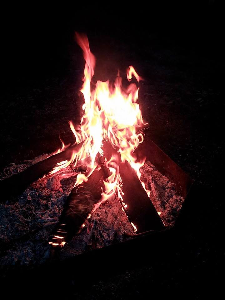
more laughter. As wagon masters, Dave and I leveled down on a corner lot that included a large patio, table, chairs and umbrella and fire pit. The site worked well as the host-spot for evening happy hours and after dinner campfires.

Unfortunately, Monday morning began with a continuous rain until mid-morning on Tuesday. Some campers weathered the precipitation and got soggy shoes, coats and umbrellas while ambling along the crushed-shell walkways of colonial Williamsburg. Several campers took to the outlet malls, while the remaining stayed warm and dry in their respective motor home or camper. A few of us gathered to meet for dinner at Bangkok Gardens, a local Thai restaurant. Due to wet chairs, wet wood and wet everything else, happy hour was postponed to the next scheduled dry evening.


Tuesday morning we were roused to the day with more precipitation having expected lakes outside our rigs because of the continuous downpour, but unhurriedly the skies began to clear, temperatures climbed a few degrees and it became tolerable toward the mid-afternoon. It did not take fellow rvers long to grab coats, umbrellas (for the anticipated return of fluid) and cameras and hit the roads to challenge cash registers along their way to our group dinner that evening in Colonial Williamsburg at Berret’s Restaurant. With cocktail hour underway we postured ourselves for the traditional group photo and then enjoyed Berret’s menu that included fresh seafood and cooked-to-order mignon, and the regional specialty of she-crab soup (sometimes it is best not to find out what is in the foods we eat!). After whimpering our way back to the campground because we are so sated, we enjoyed a pleasant campfire.


The remainder of the week everyone explored their preference of the many facets of Williamsburg, whether to walk near the footfalls of the first colonists of Jamestowne or listening to the intensity and passion of those who interpret and preserve the history of such noble historians such as Patrick Henry and Thomas Jefferson by breathing life into their historic words.
Each evening we gathered at site 38 for happy hour, where we shared our adventures of the day along with beverages and snacks, followed by evening campfires.


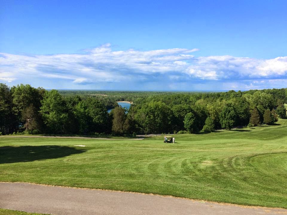
There are so many things to see and do in the area. Some days we just got in the Jeep and followed the colonial parkway to see where it would lead through the pine and hardwood forests. 

One of these days found us at the shoreline of the York River in Yorktown, where we sat on a shaded bench and watched the new class of Coast Guarders cast off for hands-on schooling and pondered the vastness of the Coleman Bridge, which spans the river to connect the tidewater areas of Virginia. This bridge is so massive its four-lane highway is the largest double-swing-span bridge in the United States. We meandered the bluffed streets of Yorktown, where there are limited reminders of its original position as a colonial hamlet. Yorktown suffered destruction from the Revolution and Civil Wars and a fire in the early 1800s that destroyed much of what remained. Unfortunately, Yorktown was not able to recover to its prosperous beginning but is once again showing its colors as the National Park Service has invested over 75 years of extraordinary effort to present and educate the public on the significance of this region in the founding and growth of our America.

There are so many various species of plant life in this tideland area. One is the BeautyBerry. It has the most interesting growing pattern. The tiny flowers become white blooms in the spring and then clusters of a purplish-red form berries in spheres on the branches of the plant.  One would assume the weight of these berries would crook the stem but they delicately spray the bough with simple elegance.


Saturday, August 16, 2014

NBNC>SYRNY: August 10 2014


How often do you have the opportunity to be sitting on a park bench in a stand of white cedars and gaze across a river and see another country? We had that chance during this week of August 10th. We have not visited the Falls in many, many years. Niagara Falls has been its consistent, spectacular self since the beginning of time; before Columbus discovered our eastern shores, before Moses parted the Red Sea, before Adam was created. The Niagara has thundered and roared. The area nearby in the historic park is being kept as natural as possible on the American border without becoming blatantly commercialized as the Canadian border appears to be. The once pleasant skyline of the Canadian side lended itself as a panoramic backdrop to the natural world, unfortunately, Canadian tourism industry has taken over the real estate along the Niagara River with restaurants, casinos, hotels and wax museums. It is sad to see. We ponder what the 1800s residents would think if they were to glance across the river now.


We began our leisurely stroll to the Prospect Point Observation Tower, built in 1961 and recently renovated in 2001. The 282 foot Tower extends out over the Niagara Gorge and gives unique and unobstructed views of the tumbling whitewater cascades of the American and Canadian Falls.  We did not go up into the tower because of the crowds but spent time on the platform leaning over the rails and looking down into the spiraling water and feeling the gentle mists of the American Falls.

We continued our stroll through the park that led us along paved walkways to a pedestrian bridge that goes over to Green Island. The original wooden bridge, built in early 1900, has been replaced with a sturdy cement bridge that crosses over the American rapids and then onto Goat Island. The newer pathway follows the serene Niagara River that intensifies its current leading to the American Falls.  
 
At the crest of the Falls we stood at the edge of the Bridal Veil Falls on Luna Island. Luna Island, all ¾ of an acre of it, is named so because lunar rainbows were seen over it on bright moonlit nights. Unfortunately, because of the nightly illumination of the Falls, moon rainbows are rarely seen today. Bridal Veil has a straight vertical fall of 78 feet and then continues its plunge onto the boulders into the Maid of the Mist pool that totals a181 foot drop.  From our vantage point we watched several tour boats, Maid of the Mist, depart from the Canadian side to pass by the American Falls and challenge the powerful current in the basin of Horseshoe Falls. These two double deck tour boats are each 80-feet, have two 350-horsepower engines that carry the 600-passenger vessels against the powerful current. The Maid of the Mist tours have been in operation for 150 years.

As we meandered Goat Island we were indulged with spectacular views of the Falls. We found ourselves in the middle of Goat Island and could hear the continuous roar of the falls but could not see its source. So we continued on until we began our downward trod to Terrapin Point, as close to the Horseshoe Falls as possible on the American side.  Terrapin Point at one time was a group of boulders that resembled giant tortoises. At first this area was accessible by footbridges to where a lighthouse sat until 1887 and was then closed due to its dangerous access. Watching the roaring thunder of the waterfall is spellbinding.  We wondered about the silence of the gorge if the water were to stop…in answer to this query we found an article that described an ice jam that dammed up at the mouth of Niagara River at Lake Erie in 1848. For nearly 40 hours the water over the Horseshoe and American Falls came to a trickle. Mills and factories that depended on the power of the water were suddenly quiet. The sound of the roar of thunderous water was silent. Some people were adventurous enough to get to the dried river bottom of the gorge and scavenged for things that had been at the bottom of the river for hundreds of years, even tomahawks, muskets and War of 1812 artifacts. While the river was quieted the crews of the Maid of the Mist even blasted away at riverbed boulders that hindered their navigation on the river. It must have been a quietness inside of quiet for those who lived near the Falls to have suddenly heard silence. To have not heard the echoing roar of the powerful force of water cascading hundreds of feet to the gorge must have been unnatural.  In 1953 and 1969 the Army Corps of Engineers intervened by building coffer dams to slow down the river’s flow to be able to study the erosion problems at the Fall’s edge.

It is tremendous to stand at the brink of this power, this intense energy, and have your senses explode with the sound of roaring thunder, the sight of millions of tons of water torrenting hundreds of feet downward, the feel of the cool mist across our faces.  The incredible volume of water never stops flowing. Incredible to think of this falling water and mist creating ice formations along the banks of the falls and river that become mounds of ice as thick as fifty feet. If the winter is cold for long enough, the ice will completely stretch across the river and form what is known as an ice bridge. This ice bridge can extend for several miles downriver until it reaches the area known as the lower rapids. Until 1912 visitors were allowed to actually walk out on the ice bridge and view the Falls from below. In 1888 a local newspaper reported that at least 20,000 people watched or tobogganed on the ice and shanties were selling liquor and photographs.  The adventure of being on an ice bridge was stopped in 1912 when the ice bridge broke up and three tourists died.

Incredible as well are those who challenge the Falls by pitching themselves over and downward. There have been, since 1901, fifteen people to dare survival of the Falls, on various flotation devices, some of which were no match for the power of the water, from barrels to kayaks to jet skis. Of these fifteen five died during their challenge. All daredevils challenged the Horseshoe Falls because of the treacherous rock formations at the base of the Americans.

We started our trek back, taking time to stop and take in the scenery, taking advantage of nicely placed park benches. And noticing that no matter where we were we could still hear the thunderous roar of the waterfalls.

Monday, July 28, 2014

NBNC>SYRNY: July 23 2014


Nine hundred and fifty eight motor home miles+seven campsites at four campgrounds=sixty days on the road. This sub-total brings us to this fourth Wednesday of July. Add to this 31 more days at this campsite in Sylvan Beach and we will begin our return to NBNC. We have extended this trip to not only continue with elder care of Dave’s parents but also to be able to see our daughter, Carol, and our son-in-law, Eric, when they visit for a week to central New York for Carol’s high school class reunion.
These past sixty days we have watched a tornado gain its strength as it blustered by and then touched down about ten miles from us, where sadly four people lost their lives; temperatures have fluctuated from the mid-50s to the high-80s; and we continue to enjoy haddock and steamed clams at various restaurants; being industrial at Dave’s parents and setting aside a few days for us to not only reminisce places we grew up around but also finding new places to bookmark in our memory manuscripts.


Sailing on Cazenovia Lake
Highlighted these past few weeks are a few road trips that led us through the tranquil valleys of Madison county to the 221-year old village of Cazenovia, where we picnicked at Cazenovia Lake. Cazenovia is an affluent community and the mc-mansions that line the roughly 8 miles of lakeside indeed causes the chin to drop and gape at the prosperousness of the owner.
 
Wind turbines in Fenner
During our journeys to Dave’s childhood home we have seen on clear days wind turbines on the mini-mountains in the distance. On the day we went to Caz we aimed for these windmills and found ourselves following rustic farm roads tunneled with wide green leaves of field corn, which led us to the township of Fenner, where we wandered near the windmill farm and were in awe of these gigantic machines that are about 215 feet high and each blade is 113 feet long. These windmills are huge! The towers are almost 14 feet in diameter at its base and the sweep of the blades creates a diameter of 231 feet. The weight of the whole assembly is 190 tons and the turbine starts producing electricity
when the wind speed reaches seven mph. We wondered what happens when the winter winds howl across the countryside and learned that the blades are feathered to allow the wind to pass by without turning the rotor. Over 6 thousand tons of ceee-ment was used to put the foundations in place at just this location where these twenty-two massive turbines bully the air currents.

Another day trip was made northeast bound towards the foothills of the Adirondacks where we circled the town of Boonville, settled in 1796, and now seems to be a declining rural town. On our way northbound on route 46 we passed through Rome (no, we did not take a wrong turn and end up in Italy!) where construction began in 1817 on the Erie Canal.
 
Pixley Falls
The canal was labored on the shoulders of immigrants from northern Ireland, where they felled trees to clear paths through virgin forests and crudely excavated earth using teams of oxen and mules. While driving through Rome we saw the reconstructed Fort Stanwix, which has been in place since the mid-1770s. It was kind of like driving past “The Alamo,” unless you saw the signage you would not have known it was there.
Pixley Falls
But we did find a Subway and got lunch for a picnic somewhere on the roadside. This led us to Pixley Falls State Park, after following the Mohawk and Black Rivers crossing through the Adirondack foothills.  After subbing at this picturesque park we followed a trail that meandered through the forest to get some Kodak-moments of the falls, but recent rains muddied our nature walk and we were resigned to listen for the surge of water tumbling over the limestone falls. On our return to camp we passed through several hamlets including Ava, which was formed in 1797, when the population began with 9 people, as of 2000, there were 725 people in this wide-place in the road. Imagine everyone knows when everyone sneezes!  
As we crossed over hill and over dale through this asphalt trail (no, we did not see any cassons, but go ahead and keep humming) we see clothes lines hung with various sized solid-colored dresses and white aprons fluttering in the gentle wind and a horse-drawn buggy clip-clopping down the road with plainly dressed children, the girls with white bonnets and the boys in broad-brimmed straw hats. More than likely they were on their way to visit a neighbor. The Amish have found rural property in this region to be more affordable than the Amish sects of Pennsylvania and Ohio. The serene image of this pastoral Kodak-moment gave us the impression of life being lived at its most simplest.

Sunday, July 6, 2014

NBNC>SYRNY: July 6 2014

July 4 2014

This week America displayed its patriotic colors from sea-to-shining sea, from its northern border to its southern border, and throughout the week pyrotechnics from sparklers to firecrackers to fireworks showing off in the darkened skies, voiced the pride of being an American and the heritage of our freedoms.


We all learned in grade school about the beginning of the Revolutionary War with shots being fired at Lexington and Concord and July 4th became the day to remember those whose determination of a new country, free of the burdens of British control. The signers of the Declaration were seen as betrayers and liable for treason; their names were kept anonymous for nearly a year to protect them and their families.


Actually, the fourth of July was not really
acknowledged by the colonies for the first twenty or so years but gained momentum after the War of 1812 and the coincidental deaths of Thomas Jefferson and John Adams, within hours of each other, on July 4, 1826, may have helped to encourage the idea of July 4 as an important date to be celebrated.  Celebrations of the Fourth of July became more common as the years went on and in 1870, almost a hundred years after the Declaration was written that Congress declared July 4 to be a national holiday.


We have picnicked over the past week with family and friends, fixing a few dozen deviled eggs and several pounds of potato salad and coleslaw to share.

NBNC>SYRNY: July 1 2014

July 1 2014

With the sun sharing its brilliant rays on this first day of July, we decided today is the day to travel to the back roads of our memories along the Seaway trail, which parallels Lake Ontario, to Oswego, where we spent our first day of July in 1971 together. Oswego is found in the northern part of New York State at the southeast extremity of Lake Ontario. 


Uncle Lloyd's Piggies ca 1950s
There are reminders, as we follow the gently rolling hills, of the picturesque sceneries of rural life and history. We pass through many hamlets, including Scriba and Lansing, where my father’s paternal ancestors lived and worked since 1875. The general store, built by my great-grandfather, still stands, where he was not only a cheesemaker, but was the post master for this area. And his son’s farm, my Uncle Lloyd’s, remains nearby, but minus the barns. Seeing Uncle Lloyd’s house gave me the shivers of memories of his “two-seater” outhouse. EWWWWWW!

Clark Farm est. 1816

Oswego area is not only historical in the formation of America, but also in the formation of my family. On the eastern edges of the Town of Oswego is Scriba and on the western line is the hamlet of Fruit Valley, known also as Union Village. Grants of land after the Revolutionary War were given in this area of wooded forest which would be cleared to be able to plant crops of corn, wheat, rye, oats and hay, to support the dairying. In 1816 my great grandfathers/uncles, Abram and Selden Clark, from Connecticut, paid $10 an acre, for their land, which they would eventually own 350 acres of this loamy soil. The original home still stands and has been renovated through the years but retains its original character.
Lake Ontario at Rudy's in winter
Lake Ontaria at Rudy's in summer


We drooled our way to Rudy’s, located on the shore of Lake Ontario, just beyond Oswego College. Rudy’s is near and dear to our hearts because this was where we went on our first date. Rudy’s has served their menu of fried haddock, salt potatoes, and coneys, for 69 seasons; they are in their 4th generation of being family owned and operated. Rudy’s is not a fast-food-processed food. They serve the best; meat is fresh from the same local butcher for the past six decades and their fish comes in daily and is prepared by hand in their kitchens. We enjoyed the best steamed clams and haddock sandwiches as we sat at a picnic table watching the waves roll in from Canada. There were the usual white-feathered rats (seagulls), cawking from overhead, but they were not as annoying as in years past.


Ontario Orchards
Ontario Orchards Fare
After looking at the emptied clams shells and dabs of tartar sauce on our plates we headed westbound toward Southwest Oswego to shop at our favorite farm market of the area, Ontario Orchards.  For nearly forty-eight years this once-small farm stand has become more than a vegetable stand. They sell homemade baked goods, local maple syrups, and delicious apple cider made from their own orchards.  We browsed the displays of apples, potatoes and fresh green peas and got some of each. 


Then we continued on our way to Hannibal, along the Old State Road. 

 This familiar road and its homes and farms along the way have aged. And as we neared my parents’ farm near Sterling it was hard not to become reminiscent of the hours of hard work and chores. Taking a few steps onto this land brought mistiness to my eyes. I miss the beauty of the valleyed farm, the perfume of freshly mown hay, the expanse of the blue skies. 
Valley View Farm from Nine-Mile Creek

 We kept on our way into Hannibal; some places very deteriorated and sad to see, and went by my high school (which gave me shivers just thinking of my English and biology teachers). 


Grand Uncle Middleton
Great Grandfather Middleton
We returned to Oswego on route 104A and the same road that we followed earlier today. On the way through Scriba, again, we stopped at the Pease Cemetery, where we found my previously mentioned grand uncle and wife’s graves, as well as that of great grandfather and gg mother.


Today was another memory maker for us as we near our 41st wedding anniversary and remember, through these pathways, the many years of places, people, and happenings.


Thursday, June 26, 2014

NBNC>SYRNY: June 26, 2014


Today is our 33rd day of our 65-day (or so) journey to upstate New York. 
We have missed the sunshine these past few days; the overcast gray clouds filled with rains dampened our spirits (and shoes). This morning the warmth of Sol greeted us and we could not waste the day so we encouraged our friend, Jean, to join us for an afternoon at the Erie Canal Boatyard Museum in Chittenango Landing.


DD Costello & Sons ca 1910
Carriage Creek ca 2014
 On the way we re-routed to North Manlius and stopped at The Carriage Creek, previously the Carriage Shop, owned by Dave's great-grandfather. Dave is named after this great-grandfather, who was a manufacturer of harnesses, wagons and sleighs in this building from 1881 until 1906. He died in 1939, after having observed his 68th wedding anniversary. It is very spiritual to walk these original floorboards that have felt to footfalls of his father when a child, his grandfather as a teenager, and his great-grandfather, as he approached his final days.
 

We continued on our way to Chittenango, passing by acres of growing corn and newly mown hay fields. We have driven past this historic site many times and decided today is the day to check it out. So glad we did. It is a humble display of life on the canal in the 19th century. Nearly 190 years ago living in Chittenago Landing was vibrant and active, where 96-foot long cargo boats were constructed and repaired.

Drydocks, which were re-discovered in 1985, have been restored and passes on the legacy of this canal community. The 524-mile canal system connects with hundreds of miles of lakes and rivers and links the Great Lakes with the Hudson River and with five waterways in Canada. A trip along the canal is a voyage into history.

As we strolled the canal landing it is not difficult to imagine the teams of mules trodding along the grassy towpaths, which are now restored for hikers and bicyclists. Other museum elements included the remains of an excavated canal boat, a sunken canal boat that would probably be more visible when the water is clear, and reconstructed woodworking and blacksmith shops and a sawmill.

We returned to the 21st century by hopping into our Jeep and going to a nearby ice cream stand for some happiness and sunshine in a cone!

Tuesday, June 24, 2014

NBNC>SYRNY: June 24,2014


“Dizzy….. I’m so dizzy my head is spinnin’” Remember that song by Tommy Roe in 1969? Tommy Roe is 72 years old now and playing the Las Vegas circuit; and since we arrived on May 27th we have been playing the Green Lakes/Sylvan Beach campground circuit. 

Hence being “dizzy”! And you may be looking at our mode of travel and saying to yourselves, ‘yah, poor babies’, but when you set up, take down, set up, take down, etc., etc., etc., (read this in Yul Brynner’s authorative voice) it becomes a harried (sans Byrnner’s shaved head) venture.

  In the past 29 days we have our first ten days at Green Lakes on site 115 (our favorite site) then we broke camp and journeyed to Treasure Isle campground in Sylvan Beach to return back to Green Lakes only two days later to site 107; then a mere five days later going back to Treasure Isle and after 72 hours revisiting Green Lakes to site 107 (de ja vu!!!), and now, nine days later we have ‘pitched our tent’ on site 24 at Mayfair campground in Sylvan Beach for thirty days.


Whew! (Wiping brow, putting up feet on picnic table bench!) Wait-do you need some Dramamine? Or perhaps you feel like humming the song, “"Dizzy”.

And here we are near Sylvan Beach, a quiet, humble village on the eastern shore of Oneida Lake, home to less than 1,200 and best known as the filming location for the 1969 movie, The Sterile Cuckoo, that starred Liza Minelli, when she was just twenty years young.  Lots of places to eat and a lake that is about 22 miles long and pretty much in the center of central New York, Sylvan Beach is popular during this region’s brief summer and just as popular when the lake is frozen tundra.


The fish of choice in Central New York is haddock. So, during these past twenty-eight days we have enjoyed a fishery’s worth of haddock, an acre’s worth of French fries, salt potatoes and coleslaw.

We have met with ‘old’ work friends and ‘older’ school friends; we have hosted gatherings at our campfires and done lots of work at Dave’s parent’s home.


We do intend to return to NBNC (at some point) and dust off the furniture before we plan our next excursion. So, stay tuned as we add snippets and oddments to this journey.